The Nautical Chart
Safely maneuvering a vessel while using positions derived from various coastal and near coastal sources is called coastal navigation. These sources include buoys, markers, identifiable objects on shore, various points of land, radio beacons, and depth soundings as examples. The basis for all navigation is the nautical chart. These are categorized on the amount of detail necessary—from very highly detailed harbor charts to those used offshore with very little detail.
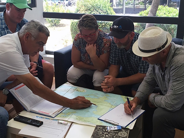
Chart Briefing in Athens Greece
Charts for coastal navigation include:
- Harbor charts that show conformations very clearly with great detail are the best source of information used to enter an unfamiliar harbor area.
- Coastal charts, also called “large-scale charts,” are useful for navigating along the shore and into the larger bays or harbors. They illustrate the local coastline features of a relatively small area in great detail and enable movement between adjacent cities along the coast.
- General charts, also called “small scale charts,” illustrate a portion of the coastal area, with only larger objects on shore and lighted objects being identified. They are used by sailors navigating more extensive distances along the coast or when sailing to coastal islands.
- Sailing charts used for offshore navigation are very small scale (1:3,500,000*). These show only ocean and land masses that border them. Water depths are available for regions of the ocean and near coasts, but only major navigational lights (lighthouses, etc.) are available. They are designed to get us across oceans; we refer to larger-scale charts as we approach the coasts.
*This would mean that 1 meter on the chart covers 3,500 km in distance. How much would 1 cm cover?
Positioning
All nautical charts display latitude, shown vertically on the left and right sides of the chart, and longitude, shown horizontally on the top and bottom of the chart. Latitude is also expressed with a North or South designation from the equator and longitude is always expressed with an East or West designation from the prime meridian. Remember that the prime meridian is a vertical line from the South Pole to the North Pole passing through Greenwich, England.
To help imagine this spatially, remember that any position in the northern hemisphere carries a north (N) latitude designation and in the southern hemisphere carries a south (S) latitude designation—that’s easy!
Anything west of Greenwich and continuing in a westerly direction ( <—that way) until about the middle of the Pacific Ocean to 180 degrees longitude, carries a west (W) longitude designation. This includes Ireland, Iceland, Greenland, the Americas, and Tahiti. Anything east of Greenwich and continuing in an easterly direction (—> that way) until about the middle of the Pacific to 180 degrees longitude, carries an East (E) longitude designation. This includes Europe, most of Africa, all of Asia, Australia, and New Zealand.
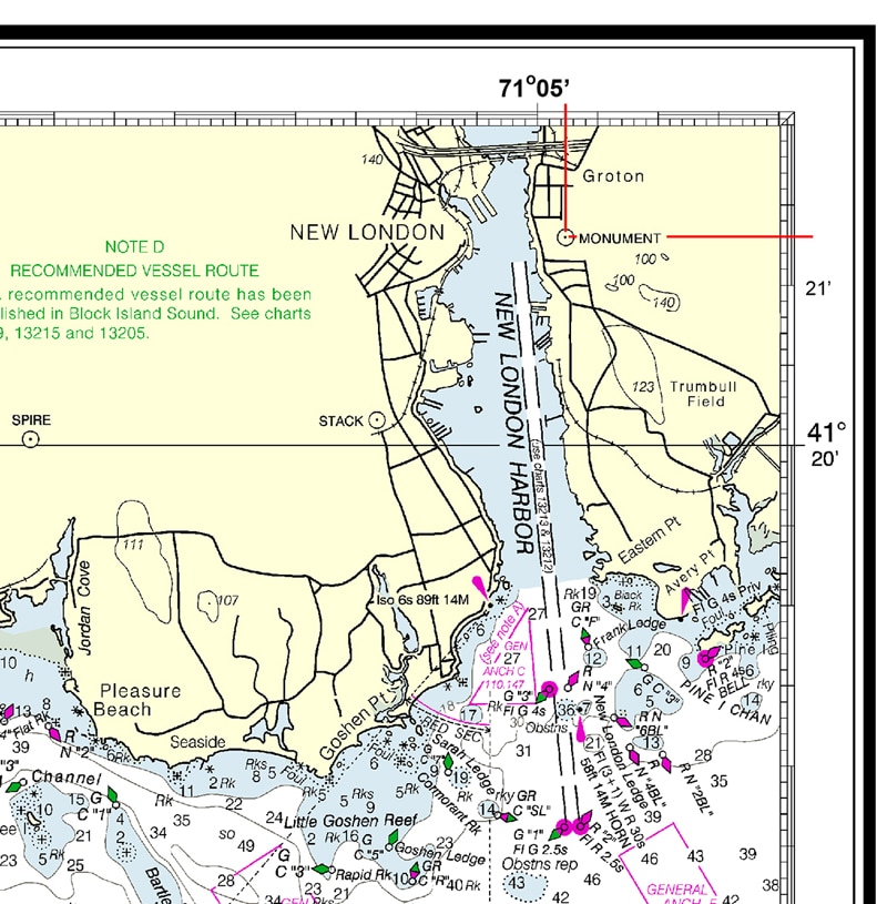
For example, on the following chart, if you were at 41 degrees 21.3 minutes North and 71 degrees 04.78 minutes West, the only place on the planet you could be is at the Groton Monument on the east side of New London harbor.
Nautical Chart
Updates
From the time that humankind first dipped toes in the water, charts have been made and updated. Today this is still an ongoing process. It is extremely important that you have the latest available chart. While rocks don’t move very much, new wrecks are created, piers are built, channels are dredged or become in need of dredging, sandbanks shift, lights and buoys are moved, removed, and added, and positions on the charts are shifted from old celestial navigation positions to much more accurate GPS defined positions.
You would not want to be sailing at night thinking that all is clear because your GPS chart says all clear then suddenly crush into a new pier built last year.
Updates to charts are found on a Notices to Mariners—search under that chart number. The best advice is to check the publication date of your charts and compare them to those available. The UK Hydrographic Office and the USA NOAA Office of Coast Survey publish chart updates.
This paragraph is a repeat for emphasis. In this day and age, we almost expect that digital information is deadly accurate and is the latest and greatest. But if you’ve ever studied databases and programming, you’re familiar with the term GIGO—“garbage in, garbage out.” Many digital charts are created from scans of old paper charts. If that chart has old or inaccurate data then your beautiful chart plotter with incredible digital information can give you wrong, wrong, wrong information.
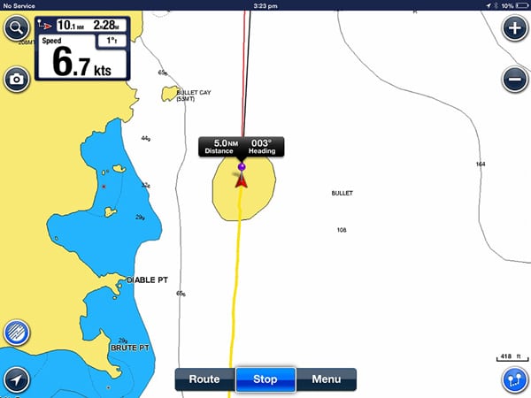
Check out me sailing through the middle of an island, that does not exist, east of Bequia Island in the Caribbean. This was a screenshot from a digital electronic chart plotter.
Nonexistent Island East of Bequia
Updates to electronic charts are often available. When you buy electronic charts, the company you buy from usually creates updates for download. Ensure you have the latest downloads of electronic charts.
True North versus Magnetic North
Chart directions are universally defined because of the spin axis of the Earth. That is, the directions are not made or defined by humans. A north direction is truly toward the point on Earth where the spin axis intersects the Earth’s surface. Because of our celestial bodies, it is highly convenient to define our north and south reference points this way.
Magnetic North is different from True North. The direction your compass points is independent (for the most part) from the spin axis of the Earth. Coincidently, it is close to the true North Pole. Like most planets, Earth has a magnetic field because of its iron core—as if a bar magnet at the Earth’s core is sending out a magnetic field into space and circling back to the opposite pole. If it were not for this magnetic field, life as we know it would not be possible because the magnetic field protects us from the sun’s radiation. The bar magnet is tilted permanently at about 10 degrees from the spin axis. But because of the motion of molten iron alloys in the outer core of the Earth, the surface pole of the magnetic field moves slowly over time. Currently, it is moving at about 60 kilometers per year and is relatively predictable from empirical data dating back hundreds of years. Thus, you will see listed on a chart the rate of change of the difference between True and Magnetic North.
When using a compass, it is important to realize that the north compass direction varies from the chart’s north direction and that this direction varies with your position on Earth. The difference between the chart True North and Magnetic North is known as the Variation.
For normal inhabitable places, the Variation ranges from 0 degrees to around 15 degrees. Of course, as you approach the poles things go haywire. These Variations are well known and each chart will list the “Variation” between True North and Magnetic North. Thus, you simply apply this correction factor of Variation to your compass reading to find the chart direction or vice versa. The Variation will be listed as a certain degree amount and if the Variation is to be applied to the West or East.
The correction is simple and should not be intimidating. For example, suppose the chart tells you that the Variation is 7 degrees West. You simply ADD 7 degrees to your chart reading to get a magnetic compass reading. If the Variation is 7 degrees East, you simply SUBTRACT 7 degrees from your chart reading to get a magnetic compass reading.
Additionally, due to ferritic metal and electronics on a boat, the compass can be further distorted from True North. This factor is called Deviation and is also further discussed in Coastal Navigation courses.
These topics are more deeply explored in the NauticEd Coastal Navigation course.

