
Learn more about planning and navigating routes on boating adventures in NauticEd’s Coastal Navigation course. Or, just sign up with the FREE (no obligation) Navigation Rules course.
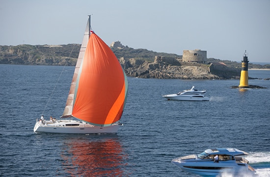
AIDS TO NAVIGATION
A BRIEF HISTORY OF GUIDING MARINERS SAFELY THROUGH THE WATERS
Navigating the open waters can be a daunting task without the right tools and knowledge. Aids to Navigation (ATONs) are essential elements designed to help mariners determine their position, chart a safe course, and avoid hazards. They serve a similar function to street signs and traffic signals on land, providing critical information that helps sailors and boaters navigate safely.
What Are Aids to Navigation (ATONs)?
Aids to Navigation (ATONs) are devices or systems used to assist mariners in navigating waterways. Formally, they include buoys, beacons, lights, radio signals, bells, transits, fog signals and more, each serving to mark channels, indicate hazards, provide positioning information, and guide vessels to safe water. Much like street signs and traffic lights, ATONs give mariners the information needed to travel safely and efficiently.
Informally, they can include a stick stuck in the reef by locals who are sick of pulling non-locals off their reef.

How Do We Use ATONs Today?
In modern maritime navigation, ATONs play a crucial role in ensuring safety and efficiency. Mariners use a combination of traditional aids (like buoys and beacons) and electronic aids (like AIS, GPS and radar) to navigate. Here are some ways ATONs are used today:
- marking channels
- Indicating hazards
- providing positioning information
- guiding to safe water
- marking special areas such as swimming or not wake zones
A Look Back: The History of Aids to Navigation (ATONs)
Aids to Navigation have evolved significantly over the centuries. Here’s a brief look at their history:
Ancient Beginnings
- Natural Landmarks: The earliest navigators relied on natural landmarks such as mountains and coastal features.
- *Primitive Markers: Ancient civilizations used markers like stone piles (cairns) on shorelines.
The Rise of Lighthouses
- The Pharos of Alexandria: Built around 280 BCE, it is one of the earliest and most famous lighthouses, guiding sailors into the harbor of Alexandria, Egypt.
- Roman Contributions: The Romans built numerous lighthouses, including the still-standing Tower of Hercules in Spain.
Medieval and Renaissance Periods
- Beacon Fires: Used on hills and towers to warn of danger and guide ships.
- Increased Maritime Commerce: Led to the construction of more sophisticated lighthouses and navigation aids.
Industrial Revolution and Standardization (18th & 19th Centuries)
- Technological Advancements: The Industrial Revolution brought powerful lighting systems like the Fresnel lens.
- In 1886, the Statue of Liberty was the first lighthouse to use electricity.
- Buoyage Systems: Standardized systems of buoys were introduced to mark channels and hazards.
- Lighthouse Authorities: Countries established lighthouse authorities, such as the U.S. Lighthouse Service, to oversee navigation aids.
Modernization and Global Standards (20th Century)
- Automated Lighthouses: Reduced the need for lighthouse keepers.
- Electronic Navigation Aids: Technologies like radio beacons and GPS revolutionized navigation.
- IALA and Global Standardization: The International Association of Marine Aids to Navigation and Lighthouse Authorities (IALA) harmonized buoyage practices worldwide into two regions: IALA-A and IALA-B.
Technological Integration (21st Century)
- Integrated Navigation Systems: Combine electronic and traditional aids to provide real-time navigation information.
- Sustainability Efforts: Emphasize environmentally friendly and automated systems.
- Virtual AIS ATONS: where no physical structure exists but an AIS signal is broadcast from another location indicating a hazard at a specific GPS point that can be seen on a chart plotter.
- Synthetic AIS ATONS: where a physical structure exists but relies on an AIS signal being broadcast from another location indicating a hazard at the GPS point of the structure allowing the structure to be visually seen and seen on a chart plotter.
The history of Aids to Navigation (ATONs) showcases human ingenuity and the relentless pursuit of maritime safety. From primitive stone piles and natural landmarks to today’s sophisticated electronic systems, the evolution of ATONs reflects our technological progress and commitment to safer seas. The journey from the Pharos of Alexandria to modern integrated navigation systems highlights significant strides in maritime safety. Global standards established by organizations like the International Association of Marine Aids to Navigation and Lighthouse Authorities (IALA) have unified and enhanced these aids, making our waters safer and navigation more efficient.
As we look to the future, the ongoing integration of sustainable practices and cutting-edge technology promises to make navigation even more reliable and environmentally friendly. The story of ATONs is far from over. With each new innovation, we move closer to a world where the risks of maritime travel are minimized, and the possibilities for exploration and commerce are boundless.
By understanding and leveraging the history and technology of ATONs, we not only honor the legacy of those who have come before us but also pave the way for future generations of mariners. The sea, once a vast and unpredictable expanse, has become a navigable and safer domain, thanks to the continuous evolution of Aids to Navigation. Let us continue this journey, ever forward, guided by the lights and signals that have long safeguarded mariners’ paths.
As a mariner, remembering the Aids to Navigation shapes, colors, and lights can seem a daunting task. But no more daunting than our daily traffic signals as we drive. We just have to see them and use them often. In our Virtual Reality Navigation Aids module, you drive a motorized dinghy down a waterway on fog or at night. You must use the aids to navigate safely.
You can learn more with the Coastal Navigation Course and Free Navigational Rules
Learn more about planning and navigating routes on boating adventures in NauticEd’s Coastal Navigation course. Or, just sign up with the FREE (no obligation) Navigation Rules course.
Author

You might also like


NauticEd is a fully recognized education and certification platform for sailing students combining online and on-the-water real instruction (and now VR). NauticEd offers +24 online courses, a free sailor's toolkit that includes 2 free courses, and six ranks of certification – all integrated into NauticEd’s proprietary platform. The USCG and NASBLA recognize NauticEd as having met the established American National Standards. Learn more at www.nauticed.org.

The NauticEd Vacations team are Expert Global Yacht Charter Agents – when you book a sailing vacation or bareboat charter through NauticEd, we don’t charge you a fee – we often save you money since we can compare prices from all yacht charter companies. PLUS, we can give you advice on which destination or charter company will suit your needs best. Inquire about a Sailing Vacation or Charter.

