How to do a Running Fix
Running Fix Explained
This week we uploaded our updated Coastal Navigation course to Apple for publishing on iTunes as an interactive eLearning App. We’re very excited about this update because of the HTML 5 animations we’ve used to explain some of the concepts.
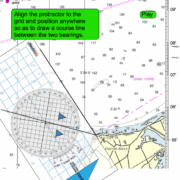
Specifically in regards to this post, no where on the web have we seen a decent explanation of how to do a very simple and elegant position fix using only one land position. The concept is called a running fix. In fact, all we found was very poor, long, complicated and sometimes wrong explanations of how it works. Certainly we found no animated interactive explanations. So as usual, at NauticEd we have broken down the seemingly complicated to the very simple.
Play this animation below then read the explanation and solution below – then watch the animation again.
If you don’t know how to use a Breton Plotter view our blogpost on how to use a Breton Plotter.
(NOTE: If you like this animation, please LIKE it on facebook and g+1 it. Thanks it really helps us grow and pay for all the free stuff we give away)
The Example Problem is:
You are sailing along on heading 57° psc (61° Mag) (47° T) your knot meter reads 5 knots. You are passing Horton Point Light to your starboard. At 1548, a hand held bearing shows that the bearing to Horton Point Light is 119°Mag (105°T). You decide to do a running fix. At 1615, the bearing to Horton Point Light is 160°M(146°T). Determine your running fix position.
Solution:
The time elapsed is
1615 -1548
or
1575 -1548 = 27 minutes (/60) = .45 hours
@ 5 knots you will travel 5 x 0.45 = 2.25 NM
You draw the true bearing line of 105° T to Horton Point Light. You then draw a vector 2.25 NM long in a direction of your heading 47° T starting anywhere on the 105° line. You then draw another line parallel to the first 105° T bearing that intersects the end point of the 2.25 NM vector. Finally, you draw in your second bearing line of 146° T. Where the 146° T line intersects the parallel 105° T line – you mark as your running fix position.
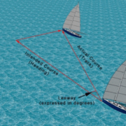
The theory behind this is simple but not usually explained. Initially you must lie on the 105 degree line somewhere but you don’t know where. You know that over the time elapsed you will travel the 2.25 NM from some where off the initial 105 deg line but you don’t know from where – yet. The parallel 105 deg line projected forward means that you will also lie somewhere on that projected line, again – somewhere. By doing the second bearing, off any object, the intersection of that bearing with the projected line means you must be at that point (given that your speed and heading were accurate).
Answer
LAT 41° 07.55’ N and LONG 72° 28.8’W
You can then draw your running vector from the fix position back to the original sighting line if you like to find your original position. This will also be your track.
Pretty slick ah? You’ll never be confused about a running fix again – and I bet you’re now wanting to get out on the water and practice next time out. Imagine trying to explain this using text and a paper book – yuk. Ahhhh no wonder people don’t like slogging through books anymore. In what?, less than a minute you grasped this concept fully.
eLearning is where it is all at.
Show off to your friends next time you’re out about your new found knowledge.
Invest in the onLine Coastal Navigation Class now
Here is the link to the iPad app for the Coastal Navigation Course (course material only does not include the test or certification)
Or – if you’re really ready to get going properly why not invest in the BareboatCharter Master bundle of courses. The Coastal Navigation Course is included and you get a bonus of the Electronic Navigation course for free AND you save a ton of $ over the A La Carte Prices. That’s the best deal ever!!!

