Autopilot sailing to a waypoint
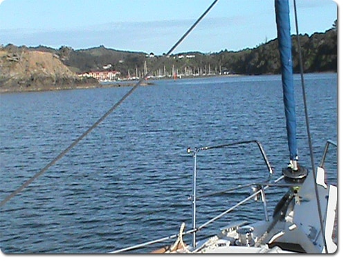
Last weekend the NauticEd crew did a boat delivery for the local Moorings Yacht Charter company in New Zealand. We sailed from Auckland up to the Bay of Islands to deliver the yacht back to its charter base. The yacht was a Beneteau 37 2012 model and was appointed well and in great condition. The first point to note for this post is that this has to be one of the most amazing coastlines to sail. It is loaded with islands and the only regret was that we had just two days to make the delivery. Thus we had to sail right past dozens of world class anchorages. A 10 day charter vacation around the Bay of Islands then down the coast and out to Great Barrier Island 25 miles off shore is not to be missed in a lifetime. On this quick trip we saw whales and dolphins with one pod riding our bow wave for 10 minutes.
The New Zealand coast line is quite amazing with its high rocky shorelines encasing stunning secluded beaches. In the evening, you just toss over the line and pull up a snapper for dinner. If you’d like to book a charter sailing vacation in New Zealand, NauticEd can help out with the booking and details and give some good advice. Contact us via this page – book sailing vacations.
Anyway I digress from the point of this post …
While there are a few reefs to be concerned with, the navigation is quite easy. We were delighted to see a B & G Zeus chart plotter on board. Reason being was that this was the example device we used in our newly launched Electronic Navigation Sailing Course. Being the author of the course I was able to really test out the device on the water. I was easily able to set the device up to view all the information I needed. Since the delivery required us to deliver on time, our VMC (Velocity Made Good on Course) was one of the most important pieces of data we needed to monitor. Since the wind was a beautiful beam reach for most of the way, we were able to dial in the autopilot to sail the waypoints that we programmed in. Most people will just dial in a compass heading into the autopilot but I think this is a mistake. It’s far safer to dial in the waypoint.
As you’ll learn in the Electronic Navigation Course, dialing in a compass heading will just point the boat on the heading which is almost assuredly not where you will end up due to leeway and current. This could take you over dangerous reefs etc. and you actually won’t arrive at your destination. Dialing in a waypoint is telling the autopilot to steer a course that will ensure the boat arrives at the waypoint in an exact straight line from the start of the navigation point. Then all you have to do is make sure that the path between the start and the waypoint is a safe course. And since it’s a straight line, it’s the shortest distance.
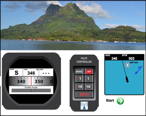
The trick to all this then is to make sure your chart plotter is “talking” to your autopilot which is usually as simple as connecting them with the appropriate cable. Then you use the menu in the autopilot to select the waypoint and hit “steer to waypoint”.
You can also use the autopilot to steer to a specific wind angle. This is mostly used when on a beat to windward. You can dial in – Steer to (say) 45 deg true wind angle. Then no matter what the wind shift, the boat will steer this angle to the wind. In the alarms panel of the device you can set up to have the device tell you if the wind has shifted any significant wind angle.
Mostly, the point of this post then is to introduce the practicality of using the electronic tools available to you when properly using a chart plotter. And during our boat delivery, we were able to apply these tools in a practical useful manner. Not to mention that it made me look like an expert infront of the fairly novice crew.
In the Electronic Navigation Course we created dozens of interactive animated simulations. This one below shows how to set up the Autopilot to steer to a waypoint or the wind.

