
Test Question: How to Determine Speed and COG
Try to answer this coastal navigation question:
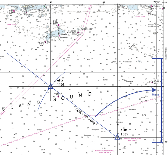
At 1035 your GPS indicated a position of LAT 41° 05.3’N and LONG 72° 33.7′ W. At 1103 your GPS indicates your position to be LAT 41°09.0′ N and LONG 72° 40.0’W. What was your SOG and COG?
Here is the excerpt of the chart that you will need
Answer: Posted below. But give it a go yourself first – really!
Consider taking the NauticEd online Coastal Navigation Course

Answer:
See chart plot here
From the plot, the distance is 6nm.
Time is calculated by realizing that 1103 = 1063. Thus:
1063
– 1035
0028 minutes
28 minutes is 28/60 hours = 0.467 hours
SOG (Speed Over Ground) = 6nm/.467 hours = 12.85 nm/hr (knots)
From the plot, and overlaying a Bretton plotter compass dial, the COG (Course Over Ground) is 307.5 deg T
Boom Done!
SOG and COG example


